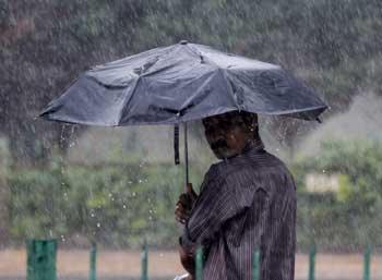
Odisha Channel Bureau Bhubaneswar, July 30: A cyclonic storm named ‘Komen’ over the northeast Bay of Bengal which was centred about 80 km southwest of Chittagong and 300 km east-southeast of Kolkata this morning has since been moving north-northwestwards and is to cross Bangladesh any time in the afternoon of today. According to a press release issued by the Union Ministry of Earth Science, after landfall, it would move west-northwestwards and weaken gradually into a deep depression this evening and into a depression tomorrow.Squally winds of speed reaching 50-60 kmph gusting to 70 kmph would prevail along and off West Bengal and north Odisha coasts during next 48 hours.Squally winds of speed reaching 40-50 kmph gusting to 60 kmph would prevail over Mizoram and Tripura commencing from today evening for next 24 hours and over Gangetic West Bengal from tomorrow morning.Fishermen are advised not to venture into the sea along & off West Bengal and north Odisha coasts during the same period.As a result of this cyclone and depression rainfall at most places with heavy to very heavy rainfall at a few places and extremely heavy at isolated places would occur over the Gangetic West Bengal and Odisha over next three days.Rainfall at most places with heavy to very heavy rainfall at isolated places would occur over Mizoram, Tripura and south Assam on today and tomorrow.Rainfall at most places with heavy to very heavy rainfall at isolated places would occur over Jharkhand tomorrow and the day after.
July 30, 2015
July 30, 2015
0 Comment
Related Articles:
- 5T Secretary reviews progress on CMO district visit grievance redressal
September 13, 2023, 11:47 am
- Patnaik announces Rs 10 lakhs each to Asian Game qualified Odisha athletes
September 13, 2023, 8:13 am
- Odisha CMO reviews grievances related to industrial development
September 12, 2023, 1:10 pm
- Odisha accelerates economic growth with approval of 9 key industrial projects
September 12, 2023, 4:02 am
- Odisha government is committed to welfare of animals: Patnaik
September 8, 2023, 4:18 pm
- Naveen Patnaik felicitates visually-challenged cricket players
September 8, 2023, 2:59 pm
- Odisha panchayat polls: Landslide victory for BJD, BJP distant second
March 1, 2022, 12:33 pm
- Hemananda Biswal: An inspiration for tribal leaders of Odisha
February 26, 2022, 5:17 am
- Hemananda Biswal passes away, to be cremated at his native place
February 26, 2022, 5:10 am
- Urban civic polls in Odisha to be held on March 24
February 25, 2022, 6:03 pm
Breaking News:
- Russia pummels exhausted Ukrainian forces with smaller attacks ahead of a springtime advance
April 19, 2024, 5:03 am - Emergency rooms refused to treat pregnant women, leaving one to miscarry in a lobby restroom
April 19, 2024, 4:01 am - Maryland high school student arrested after authorities discovered a 129-page document detailing school shooting plan, police say
April 19, 2024, 2:28 am - Israel attacks Iran, sources say, drones reported over Isfahan
April 19, 2024, 1:54 am - Hear what Trump said minutes after jury was seated in hush money trial
April 18, 2024, 10:46 pm - Fact Check: People Are Claiming Trump Never Attended His Children's Graduations. Here's What We Found
April 18, 2024, 9:22 pm - 3 teenagers shot after man opens fire in Las Vegas neighborhood
April 18, 2024, 9:11 pm - Trump loses bid to halt Jan. 6 lawsuits while he fights criminal charges in the 2020 election case
April 18, 2024, 8:45 pm - 3 people arrested in kidnap, torture case in San Jose: police
April 18, 2024, 8:34 pm - Ilhan Omar's daughter mocked as 'psycho' after college suspends her for anti-Israel demonstrations
April 18, 2024, 8:33 pm


